Drone mapping and surveying in Murcia
Drone surveying, photogrammetry, LiDAR and thermography across the Region of Murcia: the huerta farmland and irrigated land of the Segura, the Campo de Cartagena, the solar PV plants of the Altiplano and the interior, the quarries and the infrastructure corridors.
Topographic surveys in Murcia: the terrain and the projects
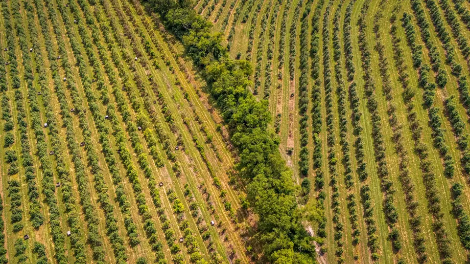
The Vega del Segura and the huerta of Murcia are flat, with small plots and a network of irrigation and drainage channels (acequias and azarbes). They need accurate DTMs, drainage network and catchment mapping, and plot orthophotos.
The Campo de Cartagena and the area around the Mar Menor concentrate irrigated farming on large estates: orthophotos, multispectral analysis and DTMs for irrigation and drainage.
The Altiplano and the interior are home to solar PV plants on extensive sites. For the design we deliver DTMs, contour lines, drainage networks and shading analysis.
The industrial estates of Murcia, Molina de Segura and Cartagena need base mapping of warehouses, roads and urban development for design and planning.
Quarries and civil works across the Region call for baseline surveys, periodic volume calculations and construction progress monitoring.
The Mediterranean rail corridor, the A-7, the A-30 and the high-voltage power lines cross the Region and are mapped and inspected with LiDAR.
The Valle del Guadalentín combines irrigated land and industrial estates around Lorca; the Noroeste, more mountainous and vegetated, is LiDAR terrain.
Drone mapping in Murcia from Xàtiva
fita is based in Xàtiva, in the Valencia region (Comunitat Valenciana), and takes on projects in the Region of Murcia with the same equipment and the same organisation.
We organise the work in full days to make the most of the journey: several plots, several sections or several warehouses on the same trip.
The equipment is the same as always: a DJI Matrice 400 drone with DJI Zenmuse L3 LiDAR, a metric RGB camera, a multispectral camera, a DJI Zenmuse H30T radiometric thermal camera, GNSS RTK and a total station.
We deliver in official ETRS89 coordinates (UTM, in the appropriate zone), ready for design, cadastre and construction.
Drone surveying services in the Region of Murcia
Services are chosen according to the terrain: photogrammetry on the huerta and industrial estates, LiDAR in the interior and in corridors, thermography on solar PV plants and roofs.
- Drone surveying of plots, industrial estates and residential developments
- Drone photogrammetry: orthophotos, DSMs and 3D models
- Drone LiDAR in the Noroeste and in linear corridors
- Thermography of solar PV plants in the Altiplano and the interior
- Precision agriculture in the huerta and the Campo de Cartagena
- Construction monitoring and volume calculations for quarries and civil works
Travel, lead times and flight areas in Murcia
We fly in any district (comarca) of the Region. The flight date is agreed when the work is planned, depending on the weather, and the deliverables arrive, as a guide, 3 to 10 working days later; somewhat longer for LiDAR with classification.
The areas around Corvera airport and San Javier air base, the Mar Menor, protected areas (Sierra Espuña, Calblanque, Cabo Cope and Puntas de Calnegre) and town centres require prior coordination or authorisation, which is part of the planning.
Questions about work in Murcia
Do you charge for travel to the Region of Murcia?
Travel is included in the quote transparently. We group jobs into full days so that it weighs as little as possible in the total.
How long does it take to deliver a survey in Murcia?
As a guide, 3 to 10 working days from the flight for orthophoto, DTM and contour lines, and somewhat longer for LiDAR with classification or long corridors. The flight date is agreed when the work is planned.
Which areas of Murcia do you cover?
The whole Region: the Vega del Segura, the Campo de Cartagena and the Mar Menor, the Valle del Guadalentín, the Altiplano and the Noroeste. The technique is chosen according to the terrain of each area.
Do you carry out surveys for solar PV plants in Murcia?
Yes. For the design we deliver DTMs, contour lines, drainage networks and shading analysis. Once the plant is operating, drone thermography locates faulty modules.
Tell us where the project is and what you need to solve
You can send us the site boundary, a plan or the specification. We will reply within one or two working days to review the scope and confirm when you can expect the proposal.