Point cloud · DTM · Corridors
Drone LiDAR survey
Drone LiDAR measures with laser pulses, and its multiple returns help record the ground that photogrammetry cannot see. We deliver the classified point cloud, the DTM and all the derived mapping, with centimetre accuracy.
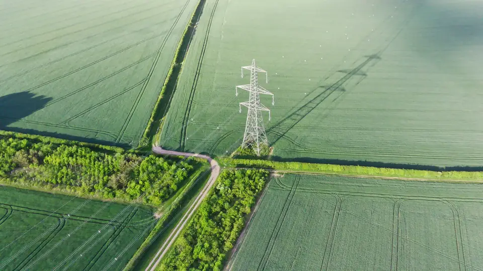
What is drone LiDAR and when is it the right choice?
A LiDAR sensor measures distances with laser pulses and records millions of points with three-dimensional coordinates.
Mounted on a drone (UAV LiDAR), it records the terrain with a very high point density. The area covered per day depends on the terrain, the sensor, the resolution required, the airspace and the planning; we set it in the flight plan for each project.
Unlike photogrammetry, multiple returns help record the ground through gaps in the vegetation. We classify the ground points and check the coverage obtained.
That makes it the right technique for woodland, tall crops, scrub-covered embankments and power line corridors.
It also works in low light and on surfaces without texture, where photogrammetry fails.
How we carry out a drone LiDAR survey
We plan the flight lines according to the required point density and the relief. In corridors, we fly along the axis of the infrastructure.
The DJI Zenmuse L3 LiDAR sensor is integrated on a DJI Matrice 400, with RTK positioning and an inertial measurement unit.
We measure ground control points and checkpoints with GNSS RTK to adjust and verify the point cloud.
In the office we compute the trajectory, generate the point cloud and adjust the flight lines to one another.
We classify the point cloud: ground, low, medium and high vegetation, buildings, conductors and towers, according to what the project needs.
What we deliver: LiDAR point cloud, DTM and derived mapping
The classified point cloud, in LAS or LAZ, is the core deliverable. It can be colourised with the RGB camera.
The points classified as ground produce the digital terrain model (DTM), including in areas with vegetation.
From the DTM we generate contour lines, longitudinal profiles and cross-sections and drainage networks. It also serves as a base or comparison surface in volume calculations.
- Classified point cloud in LAS or LAZ
- DTM and DSM in GeoTIFF or ASC
- Contour lines and profiles in DWG or DXF
- Conductor and tower modelling in power line corridors
- Accuracy and density report in PDF
Drone LiDAR accuracy and quality control
The typical vertical accuracy of a drone LiDAR survey is in the centimetre range, expressed as root mean square error (RMSE) on open ground or well-defined surfaces, in the project reference system (ETRS89 / UTM, with orthometric heights unless another reference is requested). The density is hundreds of points per square metre, depending on flight altitude.
It is checked against independent checkpoints that are not used in the adjustment, and against the overlap between flight lines. It depends on the sensor, the flight altitude, the ground control and the vegetation. The accuracy for each project is agreed in the proposal and documented in the control report.
We deliver a report with the residuals at the checkpoints and the density achieved.
Under very dense vegetation, the coverage of ground points can be sparse. We check it, state it in the report and adjust the flight if needed.
What a LiDAR survey is used for: sectors and applications
High-voltage power lines: conductor modelling, clearances to vegetation and ground, tower inventory.
Renewable energy: DTM of hillside and scrubland plots for solar PV or wind farm layouts.
Roads and railways: corridor mapping with embankments and ditches, even under vegetation.
Civil works and quarries: volume calculations and slope monitoring.
We carry out LiDAR surveys in the Valencia region (Comunitat Valenciana) and across the rest of Spain and Europe.
How much does a drone LiDAR survey cost?
The price depends on the area or the length of the corridor, the required density, the classification and the derived products.
A LiDAR survey costs more than a photogrammetric one because of the equipment and the processing, but it avoids fieldwork on difficult ground.
Send us the boundary or the alignment and the deliverables you need to receive a quote.
Questions about Drone LiDAR survey
What is the difference between LiDAR and drone photogrammetry?
LiDAR measures directly with a laser, and its multiple returns help record the ground through gaps in the vegetation. Photogrammetry reconstructs from photos and only sees what the camera sees. For open ground photogrammetry is usually enough; for woodland and corridors, LiDAR.
Can LiDAR see the ground beneath vegetation?
In many cases, yes. Multiple returns help record the ground through gaps in the vegetation. We classify the ground points and check the coverage obtained. Under very closed vegetation that coverage can be sparse, and we state it in the report.
How accurate is a drone LiDAR survey?
Typical centimetre-level vertical accuracy (RMSE) on open ground, checked against independent checkpoints measured with GNSS RTK. The delivery report includes the residuals and the point density achieved.
Can public PNOA LiDAR data be used instead?
It is useful for preliminary studies and options. PNOA-LiDAR data, from Spain's National Aerial Orthophoto Programme, usually have a much lower density and the date of their flight. For each site, it is worth comparing the date, resolution, accuracy and detail with what the project requires. A survey of our own provides the current date, the density and the control that detailed design requires.
Do you deliver a classified point cloud?
Yes. We classify ground, vegetation by height, buildings and, in power line corridors, conductors and towers. The classification is adapted to what you will do with the data.
Related products and sectors
- Digital terrain model (DTM)
- Digital surface model (DSM)
- Contour lines
- LiDAR and photogrammetric point clouds
- Longitudinal profiles and cross-sections
- Drainage network and catchments
- Solar shading analysis for PV plants
- Renewable energy: solar PV and wind
- High-voltage power lines
- Roads and railways
- Civil works and quarries
- Glacier mapping: ice velocity and glacier change
Tell us where the project is and what you need to solve
You can send us the site boundary, a plan or the specification. We will reply within one or two working days to review the scope and confirm when you can expect the proposal.