OBJ · FBX · 3D Tiles · LAS
3D models from drones
A drone 3D model reproduces the real geometry and texture of a site, a building or an infrastructure asset. We build it with 3D photogrammetry, adding LiDAR when needed, and deliver it as a textured mesh or a point cloud. It is the base of what is now called a digital twin of the terrain.
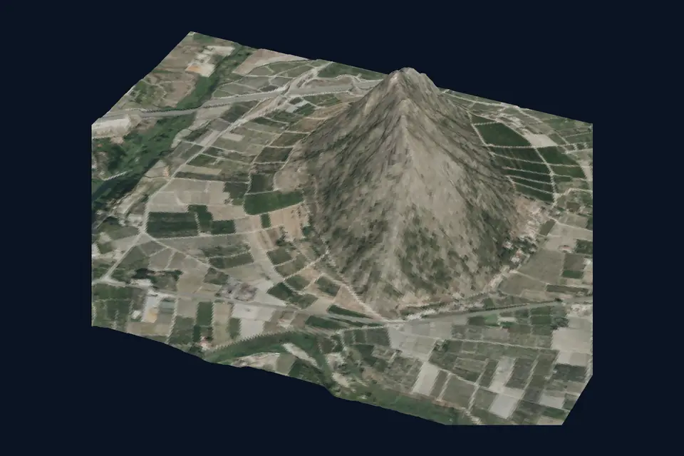
What is a drone 3D model
It is a three-dimensional, measurable and georeferenced representation of what is on the ground. It can be a point cloud or a triangle mesh with the texture of the photographs applied on top. Unlike a render, each vertex is in its true position with centimetre accuracy.
It is for viewing, but above all for measuring: distances, heights, roof areas, volumes and sections. And for bringing into the design workflow, whether CAD, BIM or GIS.
Digital twin of the terrain: what it is and what it is not
A digital twin is a digital replica of a physical asset that is kept up to date and connected to data. In mapping, the digital twin of the terrain is the georeferenced 3D model of a plot, a construction site or an infrastructure asset, with its layers of information and its versions over time.
What we deliver is the geometric base of that twin: the accurate 3D model at a given date, and the following models from each monitoring flight. The connection to sensors, maintenance or operations is provided by the client's system. An isolated 3D model should not be called a digital twin; it is the first step, not the whole.
How it is produced: 3D photogrammetry and LiDAR
For 3D photogrammetry, the drone flies a double grid with oblique shots, so that façades and sides are photographed from several angles. The software computes the position of each image, generates the dense cloud, builds the triangle mesh and applies the texture. GNSS RTK control points fix the scale and the coordinates.
Where there is vegetation or thin structures, or the ground has to be recorded through gaps in the trees, LiDAR is added. The laser cloud provides geometry where photogrammetry fails, and the photographs provide colour and texture. The combined result is a complete and faithful model.
3D model accuracy and formats
The usual GSD is 2 to 5 cm/px: it is the image resolution, not the accuracy of the model. Typical accuracy of a 3D model from drone photogrammetry is 2 to 5 cm, expressed as root mean square error (RMSE) on open ground or well-defined surfaces, in the project reference system (ETRS89 / UTM, with orthometric heights unless another reference is requested). It is checked against independent checkpoints that are not used in the adjustment. It depends on the sensor, the GSD, the ground control and the vegetation. The accuracy for each project is agreed in the proposal and documented in the control report.
Textures keep the detail of the original photos. On very thin elements (railings, cables, mesh fencing) the photogrammetric mesh loses definition; that is where LiDAR adds value.
We deliver the textured mesh in OBJ, FBX or glTF for CAD, BIM and visualisation; in 3D Tiles for publishing in a web viewer; and the point cloud in LAS or LAZ. All in ETRS89 UTM, with the coordinate origin documented so that it fits the project.
What a 3D model is used for
The most frequent uses in the sectors we work with:
- Architecture and urban planning: existing condition of buildings, roofs and surroundings for refurbishment projects and planning.
- Civil works: a model of the site at each visit, comparable with the BIM design.
- Industry: warehouses, roofs and industrial estates for inventory, rooftop solar PV and maintenance.
- Infrastructure: bridges, towers and slopes for inspection and documentation.
- Quarries and stockpiles: volumes and changes between dates.
- Presenting projects to clients and authorities on a real model.
Questions about 3D models from drones
What is a drone 3D model?
A three-dimensional, georeferenced and measurable replica of a site, building or infrastructure asset, built from drone photographs and, where needed, LiDAR. It is delivered as a textured mesh or a point cloud.
What is a digital twin of the terrain?
A georeferenced 3D model of a site or infrastructure asset that is updated over time and connected to other data. We provide the accurate geometric base at each date; the operating platform is provided by the client.
How accurate is a 3D model from photogrammetry?
A typical RMSE of 2 to 5 cm on clear surfaces. The pixel size (GSD) sets the resolution; the accuracy also depends on the control points measured with GNSS RTK. We check it with independent points and document it in the control report.
What format is a 3D model delivered in?
OBJ, FBX or glTF for CAD, BIM and visualisation, 3D Tiles for viewing in a browser and LAS or LAZ as a point cloud. We state the coordinate system so that it fits the project.
3D photogrammetry or LiDAR for a 3D model?
Photogrammetry gives real texture and good geometry on visible surfaces. LiDAR adds accuracy on vegetation, cables and thin elements. On many jobs we combine both in the same flight.
Tell us where the project is and what you need to solve
You can send us the site boundary, a plan or the specification. We will reply within one or two working days to review the scope and confirm when you can expect the proposal.