Multispectral · NDVI · Counts
Precision agriculture with drones
The multispectral camera captures what the eye cannot see. Its bands produce NDVI and other indices that reveal stress, irrigation faults and differences in growth, plant by plant. Remote sensing at farm scale, on the date you need it.
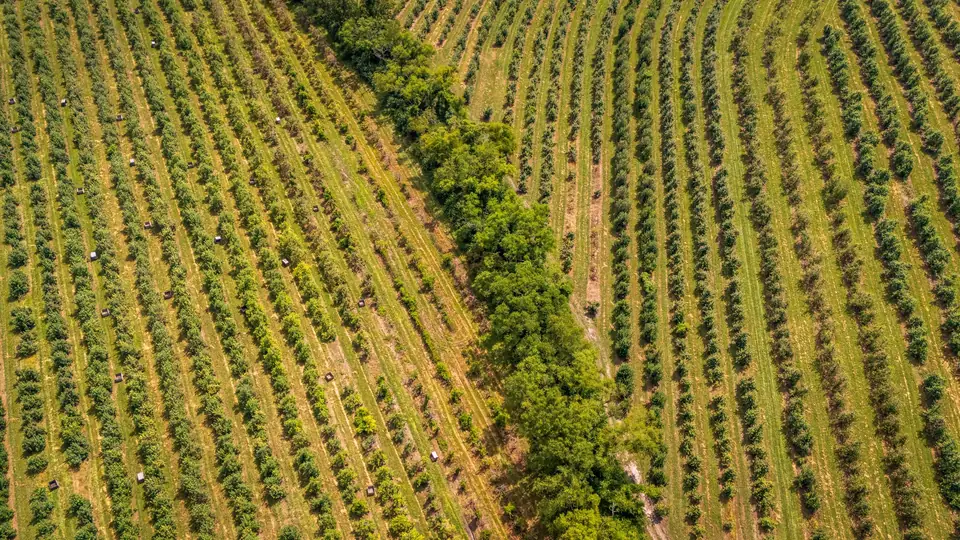
What is precision agriculture with drones?
Precision agriculture with drones uses aerial imagery to understand the state of the crop plot by plot and plant by plant.
A multispectral camera captures bands the eye cannot see (red edge and near infrared) that respond to the vigour of the vegetation.
Those bands produce indices such as NDVI, which highlight areas with stress, lack of irrigation, pests or differences in growth.
It is remote sensing at farm scale: the same technique as satellites, with centimetre resolution and on the date you need it.
How we carry out a multispectral drone flight
We plan the flight at the crop stage of interest and in stable light conditions.
We fly a multispectral camera and an RGB camera at the same time, on board a DJI Matrice 400.
We calibrate reflectance so that the indices are comparable between flights and dates.
We georeference with RTK so that each plant has the same position in every flight.
We process the bands, calculate the indices and generate maps by plot or by management zone.
What we deliver: NDVI, water stress and crop maps
Maps are delivered in GeoTIFF and SHP, compatible with QGIS and with variable rate machinery systems.
The farm orthophoto is also useful for plot management and as supporting evidence in subsidy applications.
- RGB orthophoto and multispectral orthophoto
- Index maps (NDVI, NDRE and others depending on the crop)
- Water stress and vigour map
- Crop classification and management zones
- Tree or plant counts and biomass estimate
- Farm DTM for irrigation and drainage
Multispectral drone uses in Valencian farmland
Citrus, persimmon, fruit trees, vineyards, olives and vegetables: detecting irrigation faults and problem plants before they become visible.
Counting trees and gaps (missing plants) in new plantations.
Monitoring crop development between dates and comparing plots.
Zoning for variable rate fertilisation or irrigation.
Beyond agriculture, the same indices are used to manage vegetation in solar PV plants and to monitor quarry restoration.
We fly farms throughout the Valencia region (Comunitat Valenciana) and in the rest of Spain and Europe.
Accuracy and comparability between flights
The resolution (GSD) of the multispectral orthophoto is in the order of 5 to 10 cm per pixel, depending on flight altitude. It is the image resolution, not its accuracy.
Calibration and RTK georeferencing make indices from different dates comparable.
The indices show relative differences. The agronomic interpretation is done together with the farm's agronomist.
How much does a multispectral drone flight cost?
It depends on the area, the number of flights in the season and the analyses requested.
A plan with several dates per season reduces the price per flight and allows comparison.
Tell us the crop, the area and what decision you want to make with the data.
Questions about Precision agriculture with drones
What is NDVI and what does it show?
It is an index calculated from the red and near infrared bands. High values indicate dense, healthy vegetation; low values, bare soil or stressed plants. It is used to compare areas and dates and does not provide a diagnosis on its own.
When should the crop be flown?
At the stages when a decision depends on the state of the plant: before fertilising, when adjusting summer irrigation, after an incident (frost, pests) or to assess a season. Several dates show how the crop evolves.
Which crops is it suitable for?
Any crop with plant cover: citrus, persimmon, fruit trees, vineyards, olives, almonds, vegetables and arable crops. In tree crops it also makes it possible to count trees and measure canopies.
Can trees be counted with a drone?
Yes. From the orthophoto and the height model each canopy is detected, giving the count, the gaps and an estimate of size per tree.
Can the orthophoto be used for subsidy applications?
The georeferenced orthophoto documents the actual state of the plot on a specific date. It can support applications and inspections; its administrative validity depends on each scheme.
Tell us where the project is and what you need to solve
You can send us the site boundary, a plan or the specification. We will reply within one or two working days to review the scope and confirm when you can expect the proposal.