Orthophoto · DSM · 3D
Drone photogrammetry
A photogrammetric flight turns thousands of aerial photographs into measurable mapping: orthophoto, elevation models (DTM and DSM), point cloud and 3D model. Georeferenced with GNSS RTK and verified with checkpoints.
What is drone photogrammetry?
Drone photogrammetry derives the geometry of the ground from overlapping aerial photographs.
The drone follows a programmed grid and captures hundreds or thousands of images with a metric RGB camera.
The software reconstructs the scene in three dimensions and georeferences it with ground control points (GCPs) measured in the field with GNSS RTK.
The result is a set of mapping products: orthophoto, point cloud, digital terrain and surface models (DTM and DSM) and textured 3D model.
It is the most efficient technique for mapping large areas with visual detail and centimetre accuracy.
How we carry out a photogrammetric drone survey
We plan the flight around the area, the required accuracy and the relief: altitude, image overlap and resolution (GSD, ground sampling distance).
A typical GSD is between 2 and 5 cm per pixel. It is the image resolution, not its accuracy. For façades or fine detail it goes down to 1 cm.
We measure ground control points and checkpoints with GNSS RTK or a total station, in the official reference system.
We fly a DJI Matrice 400. The drone's RTK positioning reduces the number of ground control points needed and improves the consistency of the block.
In the office we orient the images, adjust the block and generate the products. Every delivery includes an accuracy report.
What we deliver: drone orthophotos, DSM and 3D photogrammetry
The orthophoto is the aerial image geometrically corrected, ready to measure on in CAD or GIS.
The digital surface model (DSM) includes buildings and vegetation. The DTM, filtered to bare earth, is the source of contour lines and profiles.
The dense point cloud and the textured 3D model are used for measurements, visualisation and digital twins of the site.
- Orthophoto in GeoTIFF or ECW, at the flight resolution
- Dense point cloud in LAS or LAZ
- DSM and DTM in GeoTIFF or ASC
- Contour lines and profiles in DWG or DXF
- Textured 3D model in OBJ
- Accuracy report in PDF
Drone photogrammetry accuracy and quality control
Typical accuracy is 2 to 5 cm, expressed as root mean square error (RMSE) on open ground or well-defined surfaces, in the project reference system (ETRS89 / UTM, with orthometric heights unless another reference is requested). The vertical error is usually slightly larger than the horizontal error.
It depends on the sensor, the GSD, the geometry of the block, the ground control and the vegetation. The accuracy for each project is agreed in the proposal and documented in the control report.
It is checked against independent checkpoints that are not used in the adjustment, and we deliver the residuals.
Where vegetation is dense, photogrammetry cannot see the ground. In those cases we propose drone LiDAR.
What drone photogrammetry is used for, by sector
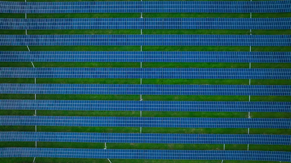
Solar PV plants and wind farms: site topography, DTM, slopes and shading analysis.
Industrial parks and urban planning: base mapping for planning and urban development projects.
Civil works and quarries: construction progress monitoring, volume calculations and comparison of models over time.
Roads and railways: corridor orthophotos and profiles for alignment design.
We work in Valencia, Alicante and Castellón, and on projects across Spain.
How much does drone photogrammetry cost?
There is no fixed price. Each project is quoted according to area, required accuracy, access and deliverables.
A plot of a few hectares with orthophoto and DTM costs far less than a linear corridor with contour lines and profiles.
To prepare a quote we need the approximate boundary (KML or plan), the products you need and the deadline.
We reply with a detailed proposal covering deliverables, formats and lead time.
Questions about Drone photogrammetry
What is the difference between photogrammetry and drone LiDAR?
Photogrammetry reconstructs the ground from photographs and provides an orthophoto and texture. LiDAR measures with a laser, and its multiple returns help record the ground through gaps in the vegetation. On open ground photogrammetry is more economical; in woodland or scrub, LiDAR is the better choice.
How accurate is drone photogrammetry?
With well distributed ground control points, the typical RMSE is 2 to 5 cm on clear surfaces. The GSD, 2 to 5 cm/px, is the image resolution, not its accuracy. We check the accuracy against independent checkpoints and document it in the control report.
How much area can be flown per day?
The area covered per day depends on the terrain, the sensor, the resolution required, the airspace and the planning; we set it in the flight plan for each project. With a GSD of 3 cm and in favourable conditions, several tens of hectares can be covered per day. At finer resolutions the area is smaller.
Are ground control points needed?
Yes, we always measure ground control points and checkpoints. The drone's RTK reduces how many are needed, but it does not replace independent verification.
What formats do you deliver in?
Orthophoto in GeoTIFF or ECW, point cloud in LAS or LAZ, models in GeoTIFF or ASC, drawings in DWG or DXF and 3D model in OBJ. If your software needs another format, we adapt it.
What permits are needed to fly?
Every flight is planned in line with current drone regulations. In restricted areas (airports, protected areas, urban environments) the necessary coordination is arranged before flying.
Related products and sectors
- Drone orthophotos
- Digital surface model (DSM)
- Contour lines
- LiDAR and photogrammetric point clouds
- 3D models from drones
- Solar shading analysis for PV plants
- Volume calculations and stockpile volumes
- Renewable energy: solar PV and wind
- Industrial parks and urban planning
- Roads and railways
- Civil works and quarries
- Glacier mapping: ice velocity and glacier change
Tell us where the project is and what you need to solve
You can send us the site boundary, a plan or the specification. We will reply within one or two working days to review the scope and confirm when you can expect the proposal.