LiDAR · Photo · Thermal
Power line inspection with drones
We inspect high-voltage power lines, towers, substations and wind turbines without interrupting service. LiDAR for the corridor and the safety clearances, high-resolution photography for detail and thermography for connections.
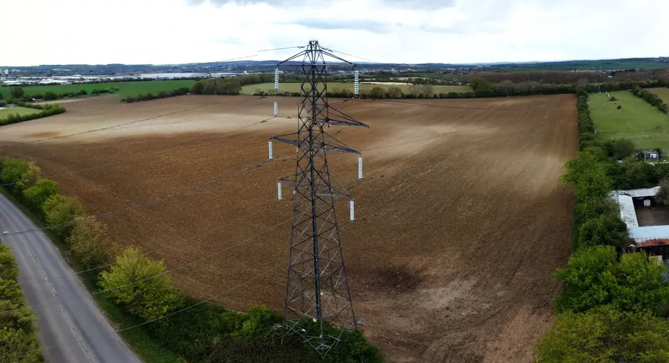
Drone inspections of electrical infrastructure
High-voltage power lines run for hundreds of kilometres across difficult terrain. Inspecting them on foot or by helicopter is slow and expensive.
With a drone, every tower and every span is inspected at close range, without interrupting service and without putting people at height.
We combine three techniques: LiDAR for the corridor, high-resolution photography for tower and hardware detail, and thermography for hot connections.
The result is a georeferenced inventory of the condition of the line.
How we carry out a drone power line inspection
We start from the operator's route and tower inventory.
We fly the corridor with LiDAR on a DJI Matrice 400: conductors, towers, vegetation and ground are captured in a single point cloud.
We photograph each tower from several angles: insulators, clamps, dampers, insulator strings and signage.
Where appropriate, we add a thermal flight to locate joints and connections with abnormal temperatures.
In the office we classify the point cloud and check the coverage of ground points beneath the vegetation. We then model the conductors and review the photographs tower by tower.
Power line inspection deliverables
Data are delivered in LAS/LAZ, SHP and DWG, compatible with line design software and with the operator's GIS.
- Classified point cloud of the corridor (ground, vegetation, conductors, towers)
- Conductor-to-vegetation and conductor-to-ground clearance analysis
- List of spans with vegetation within the safety clearance
- Photographic inventory by tower with issues marked
- DTM and profiles of the corridor
- Thermal report on connections, if contracted
Infrastructure inspection: wind turbines, substations and telecoms
Wind turbines: detailed photography of blades and tower to locate erosion, cracks and damage.
Substations: thermography of connections and equipment without entering the danger zone.
Telecommunications towers: condition of antennas, structure and anchorages.
Each inspection is adapted to the operator's maintenance protocol.
Accuracy and safety of drone inspections
The typical accuracy of the corridor LiDAR is in the centimetre range, expressed as root mean square error (RMSE) on open ground or well-defined surfaces, in the project reference system (ETRS89 / UTM, with orthometric heights unless another reference is requested).
It is checked against independent checkpoints that are not used in the adjustment. It depends on the sensor, the flight altitude, the ground control and the vegetation. The accuracy for each project is agreed in the proposal and documented in the control report.
Photographic inspection is carried out at a safe distance from the conductors, with the drone outside the zone of electrical influence.
Flights are coordinated with the operator and comply with current drone regulations.
We work for operators and contractors in the Valencia region (Comunitat Valenciana) and across the rest of Spain and Europe.
How much does a drone power line inspection cost?
It depends on the length of the corridor, the number of towers, the techniques combined (LiDAR, photography, thermal) and access.
Periodic inspection of the same line is more economical: the route and the inventory are already prepared.
Send us the route (KML) and the number of towers to receive a quote.
Questions about Power line inspection with drones
Does the line need to be switched off for the inspection?
No. The drone inspection is carried out with the line in service, at a safe distance. Thermography also needs the line under load to detect hot connections.
What does a drone inspection detect that a ground inspection does not?
The detail of the upper part of the tower (insulators, clamps, dampers) from several angles, the actual clearances from the conductors to vegetation and ground, and connections with abnormal temperatures.
Do you calculate safety clearances to vegetation?
Yes. With the classified LiDAR point cloud we model the conductors and calculate the clearance to vegetation and ground along the whole span. We deliver the list of points that do not meet the clearance set by the operator.
Do you inspect wind turbines?
Yes. Detailed photography of blades and tower to locate erosion, cracks and damage, with each image referenced to its position on the blade.
What formats do you deliver?
Point cloud in LAS or LAZ, analysis layers in SHP or DWG, DTM in GeoTIFF, photographs in JPG organised by tower and a report in PDF.
Tell us where the project is and what you need to solve
You can send us the site boundary, a plan or the specification. We will reply within one or two working days to review the scope and confirm when you can expect the proposal.