multispectral · orthophoto · DTM
Agriculture
Precision agriculture starts with seeing the whole field, in detail and at the right time. With metric RGB and multispectral cameras on a drone we produce orthophotos for the CAP (EU Common Agricultural Policy) and SIGPAC (Spain's agricultural parcel system), vigour and water stress maps, tree counts and the topography of the farm for irrigation and drainage.
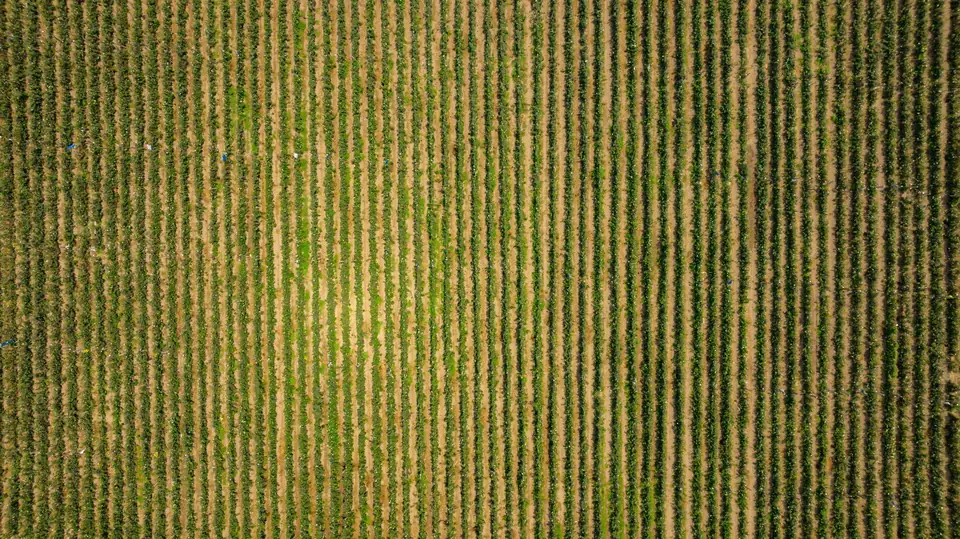
Seeing the whole field, in time
A large farm cannot be walked every week. Irrigation problems, pests and deficiencies are detected late, once they can be seen from the track. And administration, from the CAP declaration to SIGPAC area checks, requires accurate data for every parcel.
The drone covers the whole farm with a resolution that distinguishes every tree and every row. The area covered per day depends on the terrain, the sensor, the resolution required, the airspace and the planning; we set it in the flight plan for each project. The multispectral sensor sees what the eye cannot: the condition of the vegetation before the damage becomes visible.
What we capture on a farm
With the metric RGB camera we produce the farm orthophoto with a GSD of 2 to 5 cm/px (image resolution), georeferenced with GNSS RTK and ready to overlay on SIGPAC. With the multispectral camera we capture the red, red edge and near-infrared bands, from which vegetation indices such as NDVI are calculated.
The thermal camera provides canopy temperature, an indicator of water stress. With LiDAR or photogrammetry we produce the digital terrain model (DTM) of the farm for the design of irrigation, drainage and terraces.
What we deliver
The farm orthophoto for the CAP and SIGPAC, with the area of each parcel measured on it. Vegetation index maps (vigour, water stress, crop classification and biomass estimation) in GeoTIFF and as management zones in SHP. The tree count, with the position and canopy size of each tree. The DTM and contour lines of the plot.
Typical accuracy is 2 to 5 cm, expressed as root mean square error (RMSE) on open ground or well-defined surfaces, in the project reference system (ETRS89 / UTM, with orthometric heights unless another reference is requested). It is checked against independent checkpoints that are not used in the adjustment. It depends on the sensor, the GSD, the ground control and the vegetation. The accuracy for each project is agreed in the proposal and documented in the control report.
All viewable on our web GIS platform, by parcel and by date, to compare how the crop develops through the season.
How it is used on the farm
The farm agronomist uses vigour maps to direct irrigation, fertilisation and treatments to the zones that need them, instead of applying the same across the whole farm. The water stress map locates irrigation faults and sectors short of water. The tree count updates the plantation inventory and detects missing trees.
The orthophoto takes care of the administration: areas for the CAP declaration, SIGPAC parcel checks and documentation of plantations. The DTM is used to design gravity irrigation, terraces and farm drainage.
Where we work
We work on citrus, persimmon, fruit, vineyard, olive and vegetable farms in the Valencia region (Comunitat Valenciana): la Costera, la Ribera and la Safor in Valencia, the Vinalopó and the Vega Baja in Alicante and the Plana in Castellón. Also in the rest of Spain.
Questions about Agriculture
What is precision agriculture with drones?
It means managing each zone of the farm according to what it needs, based on data captured from the air: orthophotos, vigour and water stress maps and tree counts. It makes it possible to direct irrigation, fertilisation and treatments where they are needed.
Can a drone orthophoto be used for the CAP and SIGPAC?
Yes. The orthophoto is georeferenced in the same system as SIGPAC and makes it possible to measure the real area of each parcel, with a typical RMSE of 2 to 5 cm checked against independent checkpoints, document plantations and check discrepancies with the SIGPAC parcels.
What does multispectral analysis detect?
Differences in vegetation vigour and photosynthetic activity, water stress, areas with deficiencies or affected by pests, and the distribution of crops. Many problems are detected before they are visible to the naked eye.
When should a farm be flown?
It depends on the crop and the objective. For the CAP, once per season. For crop monitoring, several flights at key moments: before summer irrigation, at flowering or before harvest.
Can the trees in a plantation be counted?
Yes. Each tree is detected on the orthophoto, with its position and canopy size. It is the basis for updating the inventory, locating missing trees and estimating production by sector.
Tell us where the project is and what you need to solve
You can send us the site boundary, a plan or the specification. We will reply within one or two working days to review the scope and confirm when you can expect the proposal.