photogrammetry · volumes · orthophoto
Civil works and quarries
In civil works and quarries, what matters is measuring the same thing, in the same way, every time. With drone photogrammetry we survey the site or the quarry at each visit and deliver the orthophoto, the digital terrain model (DTM) and the volume calculations that site supervision, the contractor and the quarry manager need to certify, plan and control.
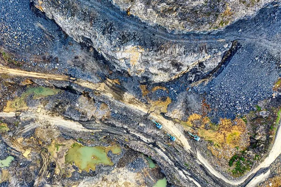
Measuring the works without stopping the works
Earthworks are one of the most disputed items in a progress valuation: how much has been excavated, how much has been filled and how much remains. Measuring with profiles at set intervals leaves gaps, and climbing stockpiles to measure them is slow and risky.
The drone surveys the whole surface of the site or quarry without stopping machinery. The area covered per day depends on the terrain, the sensor, the resolution required, the airspace and the planning; we set it in the flight plan for each project. Each flight leaves a dated model that can be compared with the previous one. Argument gives way to objective data, with its method and accuracy check documented.
What we capture on a construction site or in a quarry
Photogrammetry with a metric RGB camera, which produces very dense models on soil and aggregate surfaces, with GNSS RTK control points spread across the site. Fixed control points are set out at the start and reused on every flight, so that the models from all dates can be compared with each other.
When the original ground has vegetation, the first flight is carried out with LiDAR before work starts: multiple returns help record the ground through gaps in the vegetation, and we classify the ground points and check the coverage obtained. That model of the original ground is one of the base surfaces against which subsequent earthworks are measured.
What we deliver
At each visit, the site orthophoto with a GSD of 2 to 5 cm/px, the DTM and the digital surface model (DSM), and the volume report. The elevation difference map (cut and fill) is delivered in GeoTIFF and the zones in DWG or SHP.
The volume is calculated within a defined area, the perimeter of each stockpile or zone, by integrating the difference between two compatible surfaces: same reference, same grid and same processing. For earthworks, we compare the current state with the previous campaign, with the original ground or with the design surface, and give cut and fill by zone. For stockpiles, the current surface (DSM) is compared with an agreed base surface: original ground, a slab or a reference plane; the inventory is given by material type.
Typical accuracy is 2 to 5 cm, expressed as root mean square error (RMSE) on open ground or well-defined surfaces, in the project reference system (ETRS89 / UTM, with orthometric heights unless another reference is requested). It is checked against independent checkpoints that are not used in the adjustment. It depends on the sensor, the GSD, the ground control and the vegetation. The accuracy for each project is agreed in the proposal and documented in the control report. The volume error depends on the accuracy of the two surfaces and on how the base is defined, and is also set out in the report.
At the end of the works, the model of the final state for the final account and the as-built documentation. In quarries, the model of the workings for the working plan and restoration.
How it is used on site
Site supervision certifies earthworks with the monthly volume calculations. The site manager compares the DTM with the design to check levels and platforms before moving on. The contractor documents progress with dated orthophotos and resolves discrepancies with subcontractors on common data. The quarry manager keeps the stockpile inventory and tracks the advance of the faces.
All dates can be viewed on our web GIS platform, with a slider to compare before and after for each zone.
Where we work
We monitor construction sites and quarries throughout the Valencia region (Comunitat Valenciana), with periodic visits from Xàtiva to sites in Valencia, Alicante and Castellón, and in the rest of Spain and Europe when the project requires it.
Questions about Civil works and quarries
How often should a site be flown?
Typically one flight per progress valuation, usually monthly, plus one at the start for the original ground and another at the end for the final account. In phases with heavy earthworks the interval can be shortened.
How accurate are drone volume calculations?
The models have a typical vertical RMSE of 2 to 5 cm on clear surfaces, checked against independent checkpoints. The volume error depends on the accuracy of the two surfaces being compared and on how the base is defined, and it is documented in the report for each flight. As all flights share the same reference and control points, the data is repeatable between dates.
Is it valid for certification by site supervision?
Yes. The report sets out the method, the control points, the error of the models, the base surface and the breakdown of volumes by area. It is objective data for certifying earthworks.
Does machinery have to stop for the flight?
No. The flight is carried out without accessing work fronts or stockpiles, and its duration is set in the flight plan according to the area and the planning. Only the area where machinery is working is avoided while the drone passes over.
Services and products for this sector
Tell us where the project is and what you need to solve
You can send us the site boundary, a plan or the specification. We will reply within one or two working days to review the scope and confirm when you can expect the proposal.