LiDAR · DTM · shading · thermal
Renewable energy: solar PV and wind
A solar PV plant or a wind farm starts with knowing the ground: elevations, slopes, shading, runoff and obstacles. We survey large sites with drone LiDAR and photogrammetry, and deliver the mapping that engineering firms use for design, piling and construction.
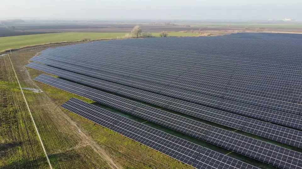
The ground drives the design of a solar PV plant
Renewable energy projects cover large sites, often with relief, vegetation and recent tracks. For placing trackers, a misjudged slope forces a change of structure, and an unseen valley line ends up as an improvised ditch.
CNIG (the Spanish national geographic information centre) publishes the MDT05, a digital terrain model (DTM) with a 5 m grid, and, depending on coverage, finer products (MDT02, PNOA-LiDAR point clouds). For each site, it is worth comparing the date, resolution, accuracy and detail of the available data with what the project requires. Public data is useful for preliminary studies and options; a survey of our own provides the current date, the resolution and the control that detailed design requires.
Drone surveying solves the problem of scale: it covers the whole area and shows the real state of the ground on the survey date. The area covered per day depends on the terrain, the sensor, the resolution required, the airspace and the planning; we set it in the flight plan for each project.
What we capture on a solar PV or wind farm site
We fly LiDAR when there are trees, scrub or tall crops: multiple returns help record the ground through gaps in the vegetation, and we classify the ground points and check the coverage obtained. With a metric RGB camera we produce the orthophoto and a dense point cloud on open ground. Ground control points and checkpoints are measured with GNSS RTK; bases and survey stations, with a total station.
On operational plants we add the thermal camera for thermal inspection of the modules: hot spots, strings without output and connection faults, located on the orthophoto.
For wind farms, the survey covers the turbine positions, crane pads, access roads and the grid connection corridor. LiDAR helps model vegetated hillsides, which are common inland in the provinces of Valencia, Alicante and Castellón; under very dense vegetation, ground coverage can be sparse, which is why we check it.
What we deliver
The engineering team receives the DTM and the digital surface model (DSM) of the site, contour lines at the project interval, slope and aspect maps, the shading analysis from the DSM, the drainage network with its catchments and the base orthophoto. All in the formats of their software: DWG for Civil 3D, GeoTIFF and SHP for GIS, LAS for the point cloud.
When the client provides the plant layout, we also calculate inter-row shading, the earthworks balance of the platforms against the design surface and the profiles of the internal roads.
Typical accuracy is 2 to 5 cm, expressed as root mean square error (RMSE) on open ground or well-defined surfaces, in the project reference system (ETRS89 / UTM, with orthometric heights unless another reference is requested). It is checked against independent checkpoints that are not used in the adjustment. It depends on the sensor, the GSD, the ground control and the vegetation. The accuracy for each project is agreed in the proposal and documented in the control report.
How it is used in the project
The DTM and slope maps are used to decide where the trackers go and which areas need levelling. The shading analysis is used to adjust pitch and orientation and to exclude areas that underperform. The drainage network is used to design ditches and crossings and to prevent erosion around the piles.
During construction, one flight per phase provides the orthophoto and DTM of the real state: it is used to measure earthworks against the previous phase or the design, check the setting-out of the structures and document the finished plant. Our web GIS platform shows all the layers in a browser, without installing software.
Where we work
From Xàtiva we cover the Valencia region (Comunitat Valenciana): the inland comarcas of Valencia, the Vinalopó and the Marina in Alicante, and the Plana and the Alto Palancia in Castellón, where solar PV and wind projects are concentrated. We also work in the rest of Spain.
Questions about Renewable energy: solar PV and wind
What survey does a solar farm need?
A DTM of the whole site, contour lines, slope maps, a shading analysis and the drainage network. With a drone, everything comes from the same survey, with a typical RMSE of 2 to 5 cm on clear surfaces, checked against independent checkpoints.
Is the IGN DTM good enough to design the plant?
For preliminary studies and options, yes. CNIG publishes the MDT05 and, depending on coverage, finer products such as the MDT02 or PNOA-LiDAR point clouds. It is worth comparing their date, resolution, accuracy and detail with what the design requires: a 5 m grid smooths slopes and does not capture ditches or walls. A survey of our own provides the current date, the resolution and the control for detailed design.
LiDAR or photogrammetry for a solar PV site?
Photogrammetry if the ground is open or under low crops. LiDAR if there are trees, scrub or tall crops: its multiple returns help record the ground through gaps in the vegetation, and we check the coverage of the ground points. In many cases we combine both in the same flight.
Do you carry out thermal inspection of solar panels?
Yes. With a thermal camera on the drone we locate modules and strings with temperature anomalies and place them on the orthophoto so that the maintenance team can find them in the field.
Do you also work on wind farms?
Yes. We survey turbine positions, crane pads, access roads and grid connection corridors with LiDAR, which helps record the ground on the vegetated hillsides where turbines are usually located.
Services and products for this sector
Tell us where the project is and what you need to solve
You can send us the site boundary, a plan or the specification. We will reply within one or two working days to review the scope and confirm when you can expect the proposal.