DTM · contours · orthophoto · 3D
Industrial parks and urban planning
Planning and urbanising an industrial or residential area starts from current, accurate mapping. We survey whole industrial estates, development land and industrial buildings by drone, and deliver the digital terrain model (DTM), contour lines, orthophoto and 3D models used by local councils, developers, engineering firms and architecture practices.
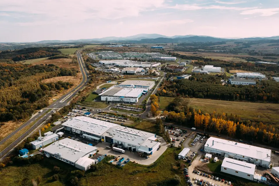
Current mapping for planning and urbanisation
A partial plan (plan parcial), an urbanisation project or the extension of an industrial estate needs the real topography of the area: elevations, walls, terraces, irrigation channels, tracks and existing buildings. Public data from CNIG (the MDT05 and, depending on coverage, the MDT02 or PNOA-LiDAR point clouds) is useful for preliminary studies. It is worth comparing its date, resolution, accuracy and detail with what the project requires, because it does not always capture the details that drive earthworks and drainage.
With a drone, the whole area is surveyed with all buildings and roads as they stand on the flight date. The result overlays the cadastre and the current planning, and is delivered in the formats requested by municipal technical services.
What we capture on an industrial estate or development site
Photogrammetry with a metric RGB camera for the orthophoto, the digital surface model (DSM) and 3D models of warehouses and buildings. LiDAR where there is vegetation or trees: multiple returns help record the ground through the gaps, and we check the coverage of the ground points. GNSS RTK for control points and checkpoints; a total station at points that require it, such as kerbs, covers and manholes on existing roads.
On warehouses and industrial roofs, the flight records the geometry of the roofs, skylights, installed equipment and parapets, which makes it possible to design solar PV installations and assess shading between neighbouring buildings.
What we deliver
DTM and DSM of the area, contour lines at the interval set by the planning (usually 0.5 m or 1 m), orthophoto with a GSD of 2 to 5 cm/px, topographic plan in DWG with existing buildings, roads and features, and 3D models of the buildings on request. For the design stage, profiles of the planned roads and the earthworks balance of the plots against the design surface.
Typical accuracy is 2 to 5 cm, expressed as root mean square error (RMSE) on open ground or well-defined surfaces, in the project reference system (ETRS89 / UTM, with orthometric heights unless another reference is requested). It is checked against independent checkpoints that are not used in the adjustment. It depends on the sensor, the GSD, the ground control and the vegetation. The accuracy for each project is agreed in the proposal and documented in the control report.
All georeferenced in ETRS89 UTM, ready to overlay on the cadastre and the planning, and viewable on our web GIS platform.
How it is used in the project
The planner or architect bases the plan on the DTM and contour lines and checks road gradients and plot levels. The urbanisation engineer calculates earthworks by comparing the DTM with the design surface, and designs drainage from the DTM and the drainage network. The developer or the council has a current inventory of the estate's warehouses, roofs and roads for management and maintenance.
During urbanisation works, periodic flights measure earthworks between phases and document progress.
Where we work
We work on industrial estates and development areas across the Valencia region (Comunitat Valenciana): the industrial areas of la Costera and la Ribera in Valencia, the Vinalopó and the Vega Baja in Alicante and the Plana in Castellón, as well as the rest of Spain.
Questions about Industrial parks and urban planning
What mapping does a partial plan or an urbanisation project need?
A current topographic plan of the area with contour lines, the DTM and the orthophoto, georeferenced and ready to overlay on the cadastre. With a drone, everything comes from the same survey.
Can it be used to design rooftop solar PV on warehouses?
Yes. The DSM and the 3D model of the buildings record the geometry of the roofs, equipment and parapets, and make it possible to calculate shading between neighbouring buildings and the usable area of each roof.
Can it be overlaid on the cadastre?
Yes. All deliverables are in ETRS89 UTM, the same system used by the Spanish cadastre, with a typical RMSE of 2 to 5 cm checked against independent checkpoints. The orthophoto makes it easy to check boundaries and encroachments at a glance.
How long does an industrial estate survey take?
It depends on the area and the deliverables. The area covered per day depends on the terrain, the sensor, the resolution required, the airspace and the planning; we set it in the flight plan. Processing and drafting come on top of the flight. A specific lead time is set in the quote.
Tell us where the project is and what you need to solve
You can send us the site boundary, a plan or the specification. We will reply within one or two working days to review the scope and confirm when you can expect the proposal.