Mapping ·
Earthworks volumes: how to compare surveys over time
Earthworks volumes from drone surveys: which surfaces to compare, what must match between surveys and which errors distort the volume before you certify.
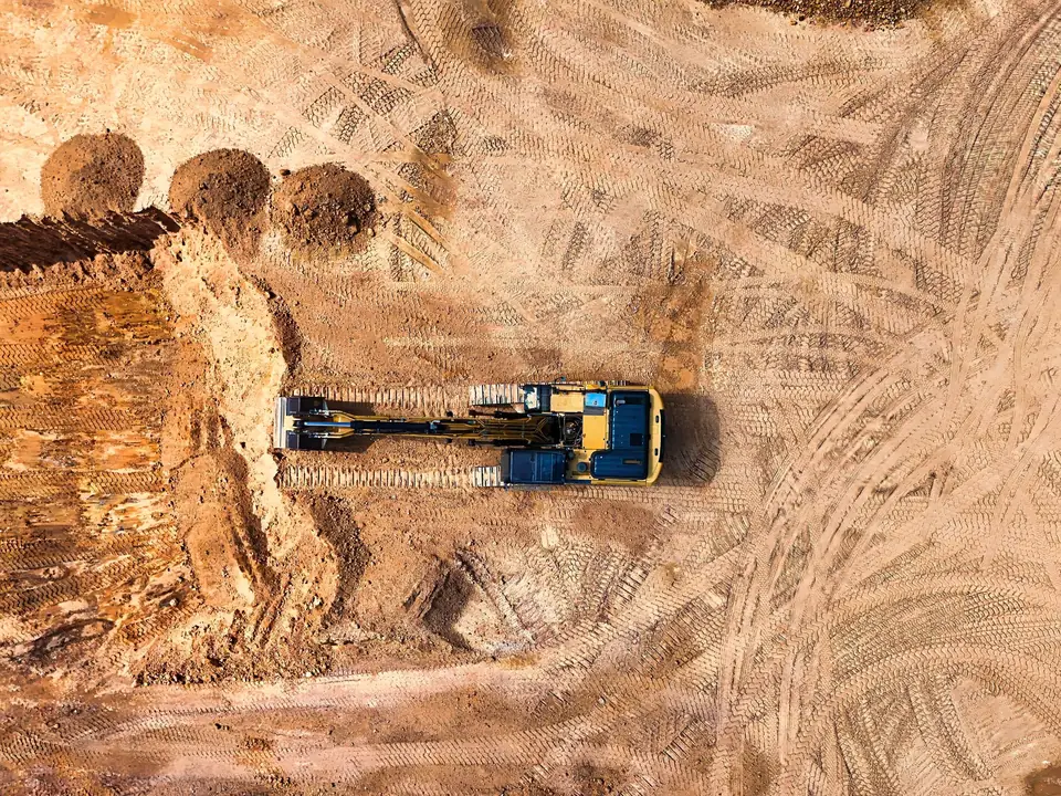
Measuring earthworks with a drone is not a matter of flying once and reading off a number. The volume comes from comparing two surfaces over the same area: the current state against the previous one, against an agreed base or against the design. If the two surfaces are not comparable, the difference measures errors instead of earth. This article explains what is compared, what has to be repeated in every survey and how the result is presented.
Earthworks volumes as a comparison between surfaces
A volume is not measured directly. It is calculated by defining an area, the boundary of a work zone, a stockpile or the whole site, and integrating the height difference between two surfaces within that area. Where the new surface lies below the reference surface, there is cut. Where it lies above, there is fill.
Each surface is a height model: a grid with an elevation in every cell. It can be a DTM (digital terrain model: the bare earth, without vegetation or objects), a DSM (digital surface model: the surface with everything on top of it) or a design surface. Simply subtracting a DTM from a DSM gives heights above the ground, but it is not a universal recipe for volumes. What matters is that the two surfaces being compared represent the same thing, with the same reference and the same processing.
Three common comparisons on site
| Comparison | Current surface | Reference surface | What it answers |
|---|---|---|---|
| Stockpile against base | Stockpile surface on the date | Original ground, floor slab or a fixed-level plane | How much material is stored |
| State against previous state | Current survey | Previous survey or baseline flight | How much has been moved between two dates |
| Design against current state | Current survey | Design surface | How much remains and where there are deviations |
All three come from the same flights. What changes is the reference surface, which is agreed before calculating and stated in the report.
What must match between surveys
A survey here means a complete capture on a given date: flight, ground control, processing and quality control. For two surveys to be subtracted from each other, four things must not change between them.
Coordinate reference system and height model
Both surfaces must be in the same coordinate system (in Spain, usually ETRS89 / UTM in the project zone) and use the same type of height. Orthometric heights depend on a geoid model; ellipsoidal heights do not. Mixing heights of different types, or from two different geoid models, shifts one surface relative to the other across the whole site. That shift appears as volume that nobody has moved.
Capture method and resolution
The same flight plan should be repeated in every survey: same technique (photogrammetry or LiDAR), same altitude, same GSD (ground sampling distance) and same overlap. The GSD is the image resolution, not its accuracy, but it governs the detail of the surface. Processing must also be the same: same cell size, same ground classification criteria and same interpolation method. Two surfaces with different cells or filters do not describe the edges of an embankment in the same way.
Fixed ground control points
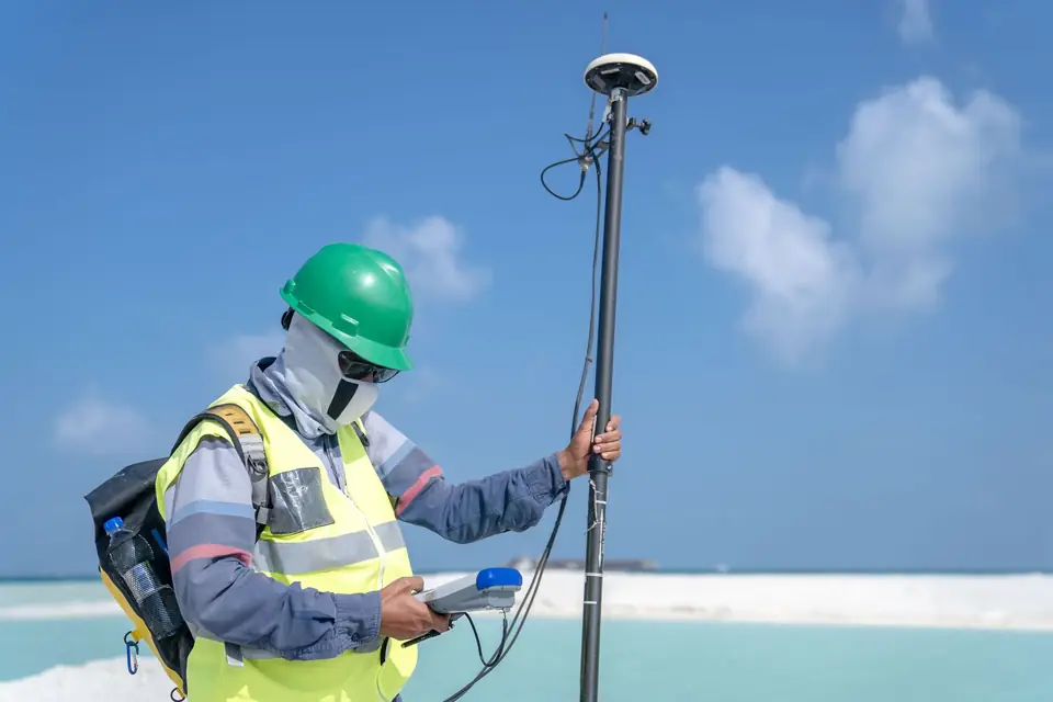
A network of permanent ground control points (GCPs), marked out in areas the works will not disturb and measured with GNSS RTK or a total station, is the foundation of the comparison. If every survey is tied to the same targets, both surfaces share the same frame. In addition, independent checkpoints are measured in every survey and are not used in the adjustment. They are used to calculate the error of each surface.
Calculation area and what counts as ground
The boundary of each zone must be the same on both dates, or the difference will include earth from outside it. It is also necessary to decide what counts as ground: plant, lorries, site cabins and temporary stockpiles are not earthworks and are excluded from the surface.
Which errors distort the difference between surveys
Earthworks volumes are calculated over large surfaces. That is why a small but systematic error carries a lot of weight. A simple calculation shows it: a vertical shift of 1 cm over one hectare is equivalent to 100 m³ that do not exist. These are the most common errors.
- Vegetation. Between two surveys, grass grows, ground is cleared or scrub appears on the slopes. If one surface records the vegetation and the other does not, the difference mixes earth and plants. On open ground, photogrammetry is enough. Where there is vegetation, LiDAR helps: multiple returns help record the ground through gaps in the vegetation. We classify the ground points and check the coverage obtained.
- Datum changes. One survey in one reference and another in a different one, a different geoid model, or a design surface delivered in another system. It is detected by comparing areas that have not changed: if a finished road appears raised or lowered, the problem is the reference, not the works.
- Gaps in the surface. Standing water, shaded areas, very reflective surfaces or areas hidden by plant leave cells with no data. The software fills them by interpolation, and that fill is not a measurement. They should be flagged in the report and, if they are large, completed with conventional surveying.
- Surfaces that are not comparable. A DSM against a DTM, a coarse grid against a fine one, or a design surface that represents the finished road level when the works are only at formation level. In that last case, the correct comparison is with the formation or subgrade surface, not with the finished pavement.
The error in the volume depends on the accuracy of both surfaces and on how the base is defined. That is why it is not enough for each survey to be good on its own: they must be good and consistent with each other.
How often to fly a construction site
There is no single frequency that suits every project. The frequency is set by the pace of the earthworks and by what the data is used for.
- Baseline flight. This is the most important one. It records the ground before the plant arrives and becomes the reference for everything that follows. Without it, the first comparison has to rely on an earlier topographic survey or on public data.
- In line with progress certification. If the project certifies work monthly, the survey is scheduled to close the period with a measured state. Some projects prefer a fortnightly or weekly cadence during the busiest phases.
- By milestone. End of site clearance, end of excavation in a work zone, completion of an embankment. Above all, before something is covered up: a layer that has been buried can no longer be measured.
- By construction phase. During bulk earthworks the ground changes quickly and it is worth measuring more often. In finishing phases there is less movement and surveys can be spaced out.
The frequency, the calculation area and the deliverables are set in the monitoring plan at the start of the project, so that the rules do not change halfway through.
How the earthworks result is presented
A volume without a method is of no use for certification or for settling a dispute with a subcontractor. The result of each comparison must allow another engineer to reproduce the calculation.
What the report includes
- Calculation area, with the boundaries of each zone or work area.
- The two surfaces compared, with their date, capture method and cell size.
- Coordinate reference system and height model.
- Cut, fill and net balance by zone, and the total.
- Checkpoints and root mean square error (RMSE) of each surface.
- Areas with no data or interpolated, and any exclusions (plant, temporary stockpiles).
Which deliverables come with it
- Height difference map (cut and fill) in GeoTIFF.
- Calculation boundaries in DWG or SHP.
- Volume tables in XLSX.
- Orthophoto for each date and the surfaces compared, ready to overlay on the CAD drawings.
- Profiles along the design alignments, when requested.
Everything can be published on a web GIS platform, with each survey as a dated layer, so that the site management team can consult it without specialist software.
Geometric volume and bulking
The volume obtained by comparing two surfaces is geometric: the void excavated or the fill placed, measured in place. The drone does not measure how the material bulks when excavated or how it compacts when placed. If the project needs the transported volume or the equivalent bank volume, the factor set by the design is applied, and the report states which one has been used.
Accuracy of each surface
With permanent ground control points and the same flight plan, the typical accuracy of each surface is 2 to 5 cm, expressed as root mean square error (RMSE) on open ground or well-defined surfaces, in the project reference system, checked against independent checkpoints. It depends on the sensor, the GSD, the ground control and the vegetation. The accuracy for each project is agreed in the proposal and documented in the control report.
Frequently asked questions
Can earthworks be measured without a baseline flight?
Yes, but with more uncertainty. The reference can be an earlier topographic survey of the site or a public model from Spain’s National Geographic Institute (IGN), such as the MDT05 or, depending on coverage, the MDT02. Their date, resolution and accuracy must be compared with what the measurement requires, and that limitation stated in the report.
Can a survey carried out by another company be used as the previous survey?
It can, if its reference system, height model, method and accuracy control are known. Ideally, the original point cloud or DTM and the control report are available, and some of the same points are measured again in the new survey. If the consistency between the two surfaces cannot be verified, the volume should be presented with that caveat.
Which surface is used to measure a stockpile?
The current surface of the stockpile is compared with an agreed base: the original ground measured before stockpiling, the floor slab of the plant or a fixed-level plane. The base changes the result, so it is agreed with the client before calculating. The calculation is made within the boundary of each stockpile.
Does the site have to stop for the flight?
No. The flight is carried out while work continues and without entering the work areas. Plant that appears in the images is excluded from the surface during processing. It does help, however, if the control targets are kept clear on the day of the flight.
If you manage a construction site, a quarry or an urban development in the Valencia region (Comunitat Valenciana) or anywhere else in Spain, our construction progress monitoring service explains how surveys are organised, and our volume calculations and digital terrain model (DTM) pages detail deliverables, formats and accuracy.
Written by the fita team, drone mapping and surveying in Xàtiva (Valencia, Spain).